Our Approach
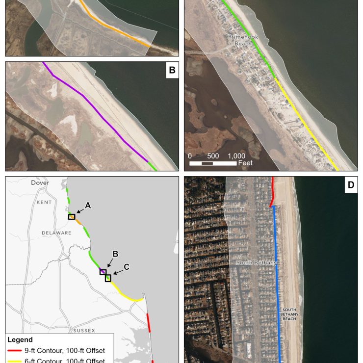
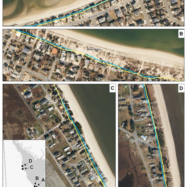
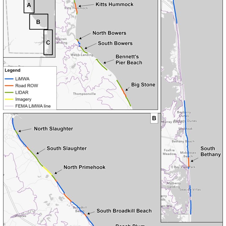
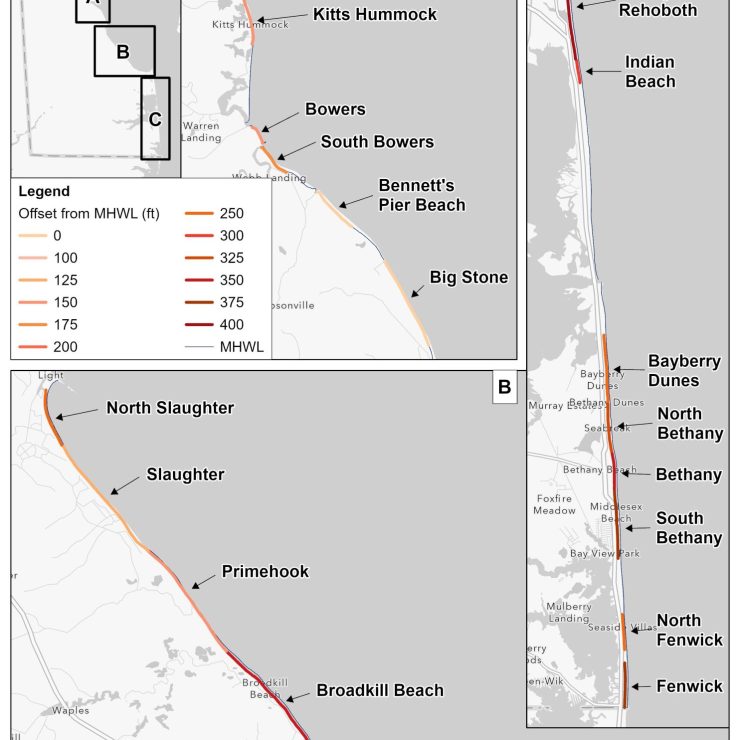
Straughan completed a project for Delaware’s Department of Natural Resources and Environmental Control (DNREC) that integrated coastal setback research and available geospatial and non-geospatial data to generate five alternative coastal building lines along Delaware’s coast. The five alternative methodologies utilized to create the building line options included: 1) Alternative 1: no action, using the current 1981 building line, 2) Alternative 2: re-delineating the line using the techniques that were established with the creation of the 1981 building line with updated topographic data, 3) Alternative 3: delineating the line based on erosion rates, 4) Alternative 4: defining the line based on the Federal Emergency Management Agency’s (FEMA) Limit of Moderate Wave Action (LiMWA) line, and 5) Alternative 5: defining the line based on offset distances from the mean high water line (MHWL).
Ultimately, Straughan compared the five alternatives on their ability to meet the intent of Delaware’s Climate Action Plan and provided technical recommendations to DNREC. Of the five alternatives considered, Alternative 4 provided the most benefit to account for changes in sea level rise, storm surge, and changing shorelines to date. This alternative was the most responsive to the need to move development limits more landward, while not drastically differing from the current building line. The ease of updating (using FEMA’s model rather than maintaining a state-owned one), credible source (federal), and the fact that it will be updated over time makes this alternative desirable.